
Lori Ballen, the owner of this website, benefits from purchases made through her affiliate links.
As an Amazon Associate, I earn from qualifying purchases. Some links on this site are affiliate links. Portions of this content are generated by AI.
Take a Hike: The Best Red Rock Canyon Hiking Trails
Red sandstone cliffs, seasonal waterfalls, and desert bighorn sheep — all about 20 minutes west of the Strip. Here are my favorite trails for every skill level.
More Things to Do in Vegas →I’ve lived in Las Vegas my whole life, and Red Rock Canyon is still the place I send everyone — visitors, new neighbors, and clients who just closed on a home and want to see why we love it out here. It’s a National Conservation Area managed by the Bureau of Land Management, not a state park, and it sits right on the western edge of the valley off Charleston Boulevard (State Route 159). Whether you want a flat, family-friendly stroll or a lung-burning summit scramble, there’s a trail here with your name on it. Below are the trails I know and love, grouped by how hard they are so you can pick the right one for your day.
Get the best things to do in Las Vegas in your inbox — free.
Plan your visit first
You need a reservation October 1 – May 31
From October 1 through May 31, a timed-entry reservation is required to drive the 13-mile Scenic Loop between 8:00 a.m. and 5:00 p.m. — even on fee-free days. Book your entry window in advance through the official Red Rock Reservations system on recreation.gov (or by phone) before you go. Outside those months and hours, no reservation is needed, but the Scenic Loop still has daily open and close times, so check ahead. This applies to the Scenic Drive; several trailheads along SR-159 outside the loop don’t require it.
The desert essentials
Entrance fees and daily hours vary by season and can change — always confirm current pricing and open times on the official Red Rock Canyon site before you head out. Bring far more water than you think you’ll need, wear real hiking shoes, and start early in the warmer months. Cell service is spotty, summer heat is no joke, and many trails cross open desert or loose rock. Leave no trace, and give the bighorn sheep and wild burros plenty of space.
Easy & family-friendly trails
Calico Basin Trail
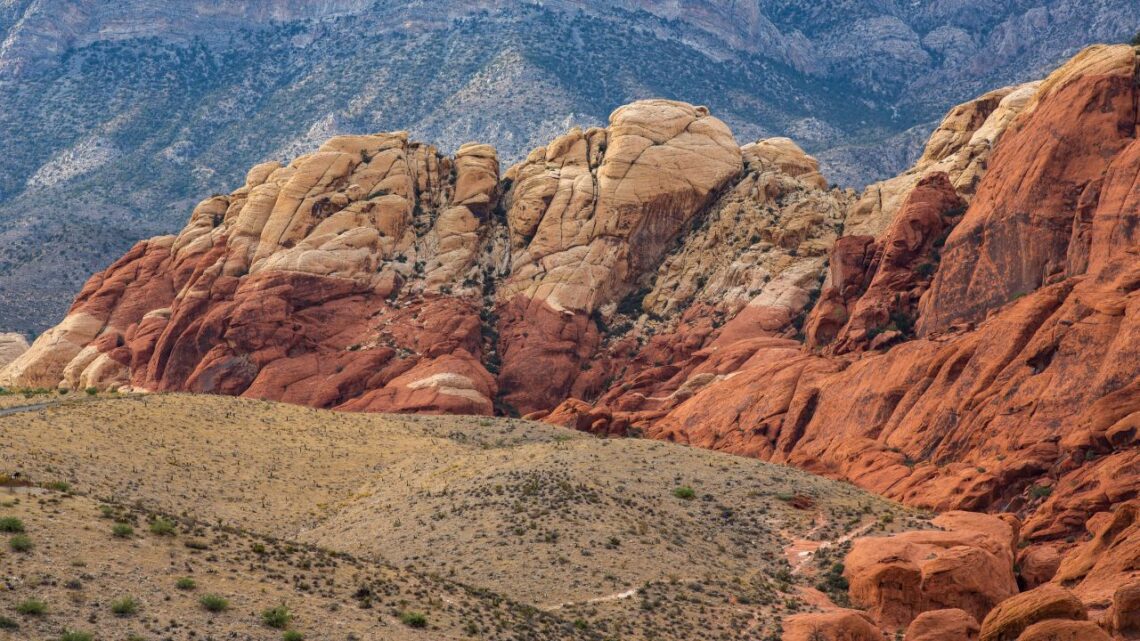
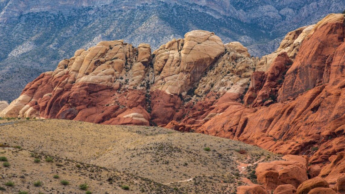
A gentle path along the base of the vibrant Calico Hills, where the rock glows pink, orange, yellow, and grey. You’ll often see sport climbers on the walls and seasonal greenery near Calico Spring, plus hawks, ravens, and turkey vultures overhead. It’s short, scenic, and one of the easiest ways to feel like you’ve escaped the city. Tip: Go at golden hour — the low light on the sandstone is unreal for photos.
Lost Creek – Children’s Discovery Trail
This self-guided interpretive loop is perfect for families and takes about an hour. Kids love the towering canyon views, the pictographs, and the little lessons about desert life along the way. The big draw is a seasonal waterfall tucked deep in the canyon, usually flowing December through April. Tip: Come after a winter rain for the best chance at the falls.
Ash Spring Trail
A short, easy walk that heads west toward the Calico Hills and leads to a lush pocket of grass and ash trees fed by a seasonal spring. It’s a quiet little oasis that draws birds and small critters, with lovely overlooks of the sandstone formations. Great for a quick morning leg-stretch. Tip: Pair it with the nearby Calico Basin trails to make a fuller morning of it.
Girl Scout Trail
Nestled in the heart of the Calico Hills, this calm, easy trail is full of color and quiet. It runs near a picnic area associated with the Girl Scouts of Southern Nevada, so there’s a natural spot to stop, snack, and soak it in. It’s a favorite for beginners and families. Tip: Pack a lunch and make it a relaxed picnic hike.
Moenkopi Loop
Starting right at the Visitor Center, this mostly flat loop wraps around a limestone ridge and is a great overview hike in about an hour and a half. Keep an eye out for desert plants and even Triassic-era fossils, with panoramic views of the Wilson Cliffs the whole way. Benches and overlooks make it easy to pace yourself. Tip: Connecting trails let you extend into the Calico Hills if you want more.
Willow Springs Loop
One of the best short hikes in the whole conservation area, this easy loop starts at the Willow Springs parking lot and passes a pictograph site and agave roasting pits — real glimpses into the people who lived here long ago. You’ll get big views of limestone cliffs and red sandstone the entire way. Perfect for families or anyone short on time. Tip: Look up and around the shaded alcoves for the rock art.
Calico Overlook Trail
This gentle loop starts from the Red Spring Picnic Area, follows the Red Spring boardwalk, and dips into a sandy wash beneath massive sandstone boulders. There’s a little elevation change but nothing that’ll wear you out. It’s a peaceful, tranquil trail that feels a world away from the Strip. Tip: The boardwalk section is stroller- and mobility-friendly if you just want the easy part.
Fire Ecology Trail
A quick, easy interpretive loop into Pine Creek Wash that tells the story of a 1992 prescribed burn and how controlled fire helps protect the tall ponderosa pines. It’s an hour or less and a nice one for curious kids. You may spot birds, chipmunks, rabbits, and squirrels along the way. Tip: Extend it toward the nearby trails for a longer loop of about 0.9 mile.
Petroglyph Wall Trail
A short walk across a wash leads to a cliffside covered in petroglyphs estimated to be many hundreds of years old, left by the Paiute and Southern Paiute peoples who lived in this area. Look for animals, plants, human figures, and geometric designs carved into the rock. It’s a small hike with a big sense of history. Tip: Look, photograph, and never touch — oils from hands damage the art.
Moderate trails
Calico Tanks
One of the most rewarding moderate hikes in the park, taking you past red sandstone and limestone up to a natural water tank with a surprise view of the Las Vegas Valley at the end. You’ll do a little scrambling, and you might see lizards, birds, or even wild burros. It’s doable for fit beginners but still feels like an adventure. Tip: Save some phone battery — the valley view from the tanks is the shot everyone wants.
Pine Creek Canyon
A gorgeous trail that moves from open desert into a shady ponderosa pine forest at the mouth of the canyon, with those big monolithic walls rising overhead. The air is cooler here and Pine Creek runs seasonally, making it feel like a completely different world. Watch for mule deer and rabbits. Tip: The old homestead foundation near the canyon mouth is a fun spot to pause.
Keystone Thrust
A geology lover’s trail that leads to one of the best examples of a thrust fault in the region — the dramatic line where gray limestone was shoved up and over the red and tan sandstone millions of years ago. It’s a fascinating, roughly 1.5-hour hike from the Sandstone Quarry parking area. The contrast in the rock colors is striking. Tip: Park in the designated area at Sandstone Quarry so you don’t risk a ticket.
Oak Creek Canyon
A scenic trek that skirts the canyon rim with beautiful views of the Red Rock escarpment. In spring the trail lights up with bluebells, lupines, and penstemons, so it’s a favorite for photographers. There are a few steep, rocky stretches, so wear real shoes. Tip: Go in the morning before the desert sun climbs over the cliffs.
First Creek Canyon
This trek heads across a desert valley to a seasonal waterfall framed by cottonwoods and willows — a genuinely peaceful payoff. The main trail is well-maintained, though the final stretch to the falls follows an unofficial use trail down the wash, so watch your footing. Even when the water is low, it’s a lovely place to rest in the shade. Tip: This trailhead is off SR-159 outside the fee loop, which can make timing easier.
South Oak Creek
A longer moderate hike that starts from a dirt pull-out along SR-159 south of the Scenic Drive exit and heads across open desert toward Oak Creek Canyon. Look for petrified wood and conglomerate rock as you climb, and keep an eye out for bighorn sheep on the ledges. The higher stretches reward you with sweeping views and, in season, wildflower meadows. Tip: Route-finding matters here — download an offline map before you lose signal.
Middle Oak Creek
Starting from a dirt pull-off along SR-159 south of the Scenic Drive exit, this trail winds through Oak Creek Canyon toward the red rock escarpment. You might spot wild horses and, if you keep your eyes open, petroglyphs left by Native peoples on the rock walls. The views at the top stretch for miles. Tip: Give wild horses a wide berth — they’re beautiful but they’re still wild animals.
Calico Hills
This trail runs along the base of the Calico Rocks between Calico Basin and Sandstone Quarry, so you can make it as short or long as you like depending on where you jump on. Expect some fun technical terrain — boulder fields and sandstone ledges — along with big views toward Mount Charleston and Griffith Peak. It’s a choose-your-own-adventure kind of hike. Tip: Access it from either the Sandstone Quarry or Calico Basin lots depending on how far you want to go.
White Rock – Willow Springs Loop
This loop begins at the upper White Rock Spring parking lot and traverses some of the prettiest scenery in the park, passing a guzzler (a man-made wildlife water hole), a wash, and a ridge that drops into the Lost Creek area before reaching Willow Springs. Spring wildflowers and rock formations make it a standout. It’s a satisfying half-day loop for hikers of most skill levels. Tip: Go counterclockwise for a gentler climb.
La Madre Spring
This hike follows an old road up a rugged canyon where red and white sandstone meet gray limestone, leading to a hidden pocket of pinyon pine, juniper, and scrub oak around La Madre Spring. The spring draws wildlife, so it’s a good one for quiet observation. It feels wonderfully remote for how accessible it is. Tip: Bring binoculars — animals often come to drink near the spring.
Knoll Trail
A varied trail with challenging inclines, rocky ridges, and smooth patches of sandstone that keep things interesting the whole way. Wildlife is a highlight here — you may see small mammals, deer, bighorn sheep, birds, and lizards. There are a few steep, boulder-strewn stretches, so good traction matters. Tip: Give yourself extra time; the views tempt you to stop constantly.
Gene’s Trail
A moderate hike across open desert through the eastern portion of Calico Basin, with a little over 300 feet of elevation change and lovely views back toward the valley. Watch for yucca and cacti along the way. It eventually merges with the Kraft Mountain Loop, so you can lengthen it or turn back whenever you like. Tip: Look for the large black trailhead sign that marks the start off SR-159.
Dale’s Trail
This route runs along the base of the escarpment with a mostly gentle grade broken up by a few short, steep sections for a little extra challenge. It’s a great choice if you want distance and scenery without a punishing climb. Birdwatchers do well here — hawks overhead, quail in the brush. Tip: It connects with other escarpment trails if you want to build a longer day.
Arnight Trail
A friendly desert trail along the base of the Wilson Cliffs, winding past low shrubs, yucca, cholla, and brittlebush at a gentle grade. Birders love it — roadrunners, quail, owls, hawks, and horned larks all show up here. You might also catch jackrabbits or coyotes. Tip: After rain, small washes may run — a rare treat in the desert.
Strenuous & summit trails
Ice Box Canyon
Don’t let the short distance fool you — this one is rated strenuous because it crosses open desert and then requires scrambling over boulders and loose rock in the wash. The reward is a shady box canyon that stays noticeably cooler than everything around it, with pools and seasonal waterfalls from about December to April. Wear shoes with real grip. Tip: Go after winter rain for flowing water, and give yourself extra time for the rock hopping.
Turtlehead Peak
One of the classic summit hikes in Red Rock, with a big elevation gain of roughly 2,000 feet that earns you a jaw-dropping panorama over the whole conservation area. It’s strenuous with technical, rocky terrain, so it’s best for hikers in good shape. In the warm months, start early or late — there’s little shade and the heat is serious. Tip: Windbreaker year-round; the summit gets gusty even on calm days.
Kraft Mountain Loop
A strenuous loop around Kraft Mountain with real elevation gain and rock scrambling that’ll get your heart going. The colorful wash of red and orange rock is the payoff, along with big views over the Las Vegas Valley from up high. Plan on a couple of focused hours and bring plenty of water. Tip: Starts at the end of Sandstone Drive in Calico Basin — go clockwise to tackle the scrambling early.
White Rock Mountain Loop
A secluded, strenuous loop that circles the colorful White Rock sandstone with nearly 1,000 feet of elevation change and a mix of habitats — pinyon, juniper, and cactus fields. A large mesa overlooks the canyon floor, and there are plenty of quiet spots to rest and take it all in. Give yourself a few hours. Tip: Great fall or spring hike; skip it midday in summer.
Grand Circle Loop
A big-day loop that strings together desert foothills and washes with multiple access points, so you can shape the distance to your energy. Beginners can enjoy the easier access sections, while stronger hikers link the full route through hills and sandy stretches. Wildlife and springtime wildflowers are part of the reward. Tip: Starting from the Visitor Center gives you the most route options and a good place to refill water.
North Peak Trail
A long, demanding route that climbs through pinyon-juniper forest to the top of the Red Rock escarpment. Portions are unmarked and require scrambling over rocks and up steep inclines, so it’s for experienced, well-prepared hikers only. The green meadows and monolithic formations along the way are unforgettable. Tip: Pack more water and food than you think you need, and turn back if the route gets unclear.
Bridge Mountain
Home to a stunning natural sandstone arch and 360-degree views, Bridge Mountain is one of the most iconic — and most serious — objectives in Red Rock. This is a long, technical route with exposure and route-finding that’s well beyond a typical day hike; the high-clearance approach road alone turns many people around. It’s a bucket-list summit for experienced, well-equipped hikers only. Tip: Research current conditions and access carefully, and never attempt it in poor weather.
What to bring
Red Rock rewards a little preparation. Pack a hat, sunscreen, snacks, and far more water than feels necessary — this is high desert, and the heat sneaks up on you. Wear sturdy shoes with good traction for the rocky and sandy sections, keep an eye on the weather, and give wildlife its space. Start early in the warmer months, tell someone your plan, and remember that many of these trails cross open desert where the path isn’t always obvious. Do that, and you’re set for one of the most beautiful days you can have near Las Vegas.
Get the Best of Las Vegas in Your Inbox
Trails, hidden waterfalls, new restaurants, shows, and events around the valley — a few good ideas in your inbox. No spam, unsubscribe anytime.
Join the Ballen Vegas newsletter — local tips from a lifelong Las Vegan. We’ll never share your email.
Book a Red Rock Canyon experience
Guided hikes, tours, tickets, and experiences for your Las Vegas trip.
Some links are affiliate links; we may earn a small commission at no extra cost to you.
Thinking about moving to Las Vegas?
There’s a reason so many people fall for this city. If you’re considering a move — or wondering what your current home is worth — my team would love to help.
Get My Home Value →Contact Lori

Lori Ballen
REALTOR® with Keller Williams Realty Las Vegas, leading The Ballen Group. A lifelong Las Vegan sharing the best of the valley.
As an Amazon Associate, I earn from qualifying purchases. Some links on this site are affiliate links. Portions of this content are generated by AI.